|
1100hrs: The weather forecast is for isolated storms and 1m seas gives us a weather window so it’s time to go. Pull up the anchor and start motoring slowly down the harbour securing everything. Wash and stow away both rolls of anchor rope below decks. The anchor and chain would have to be the muddiest they’ve been on the whole trip so far and has to be cleaned with buckets of water and brooms. Move some empty jerry cans off the deck to make more room up there and re-stash them below.
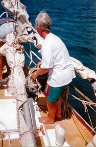 Right: Anchor aweigh. Martin securing the anchor to make sure it doesn’t clunk around. Delma standing by to wash the mud off the deck. Right: Anchor aweigh. Martin securing the anchor to make sure it doesn’t clunk around. Delma standing by to wash the mud off the deck.
1200hrs: Clear of Saumlaki Harbour. Sea swells getting bigger. Halfway between Matakus Island and the Yamdena Strait light. Heading southerly to clear some shoal banks, then will be turning SW towards the western end of Melville Island, Australia.
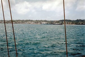 Left: Our last view of Saumlaki. The main wharf is centre photo. Left: Our last view of Saumlaki. The main wharf is centre photo.
Sails put up with 2 reefs in mains’l and #2 jib. Motor off and we’re away!
1400hrs: Shake out one reef in mains’l leaving one reef in. Still have #2 jib for the time being but wind is dropping. Out into open ocean swells. Pretty big stuff which takes the edge off our speed in the troughs.
Big pod of dolphins pass underneath. Don’t stop to play but after we pass by they start doing acrobatics, jumping high out of the water and flopping back.
1430hrs: Made only about 3.5 knots last hour. Take down the #2 jib and put up the larger #1 jib. Speed picks up to 4.5~5 knots. Almost at the continental shelf where the water drops from around 60m to over 200m before it gets really, really deep.
1455hrs. Crossing the shelf. Waves quite big with the open ocean swells hitting the relatively shallower water.
1700hrs: Pass an Indonesian offshore fishing boat. He has an anchor rope out but can’t be anchored so must be using a sea-anchor drogue of some sort off his bow. His small boat pitches horrendously in the short sharp swells yet he walks nimbly on it apparently unconcerned and untethered.
Situated 24 nm SSW of Saumlaki and east of the most southern point of Selaru Island at 20 nm away to the west. Still running with #1 jib and mains’l with one reef. Winds variable but getting anywhere between 4~6 knots. Waves are more settled into swells but still a reasonable size. Some whitecaps around. Boat handling no effort on the tiller at all. Well balanced and sails trimmed okay. Really, really pleasant sailing. Just lovely!
Ann feeling a little sick after taking her Doxy tablet this morning. Delma is okay at this time as she took hers last night. Crew starting to settle into routine. Rosters done.
Pass through some local showers during the afternoon which take away our wind as they go over and slow us down. Sun comes out later and the wind starts to stabilise.
Dusk: Uneventful sailing. Lack lustre sunset.
Tue 22 Sep 98
Overnight: More uneventful sailing overnight. Quite pleasant. Wind swung from SE to E from forward of the beam to aft of the beam. Maintained roughly 4.5~5 knots and sometimes higher. Winds variable in strength. Occasional lulls where we dropped down to 3 knots. No moon at all but the stars put out enough light to see around the boat a little bit.
0930hrs: Shake out the last reef in mains’l. Immediate results from under 4 knots to over 5 knots. Still getting lots of lulls which slow us down overall.
1100hrs: Posn: 09 degrees 33.34’S, 130 degrees 38.28’E. Roughly 135 nm in the 24 hours from Saumlaki. Making good time. Almost boring routine. Average speed between 4~5 knots. Big tanker on horizon is crossing our stern. Probably came from Gove with a load of Bauxite.
Approx 1400hrs: Cross the Australian Fisheries Zone. Now in Australian waters.
1700hrs: Cross the Australian continental shelf.
1800hrs: Have been charging along most of the afternoon at 6 knots or more. Wind 10~15 knots. Some occasional lulls drop us down to 4.5 knots and some gusts speed us up to over 7 knots at times. Great sailing and making good time. Roughly 170nm SSW of Saumlaki. Waypoint is 60 nm away at 11 degrees S, 130 degrees E. Hopefully we’ll then turn more southerly to follow the west coast of Bathurst Island.
Evening: Sumlog which records distance travelled through the water gives up sometime around 2000-2100hrs. Just stops at 150nm.
Wed 23 Sep 98
0030hrs: A startling noise just off the starboard quarter. Wonder what that was? Wave? Another one just off to port maybe 10 metres away. Distinctive phosphorescent shapes identifies a pod of dolphins following the boat. Ann and Delma came out to look. Can’t see much but the puh sound of them exhaling and gulping air can be heard all around the back of the boat. Occasionally a bright streak flashes through the water. They stay with us only for about 5 minutes then leave.
0400hrs: Passing over Goodrich Bank. Course takes us to the right of Marie Shoal which is charted at 8m deep. Not a problem in itself but these sorts of things can cause bumpy water.
0700hrs: Another uneventful night. Started losing the breeze from about 0415hrs onwards. Wind kept coming behind the mast so that the mains’l blanketed the heads’l. Sheeting in the mains’l got more air into the heads’l. Sometimes the unconventional works.
0850hrs: Just 1 nm from waypoint. Wind keeps puffing and dropping. Seems to be taking forever to get to it. Change course to 185 degrees True for the next waypoint off Cape Fourcroy. This is at the SW point of Bathurst Island. We have 55 nm on this leg to go.
1230hrs: Travelling down the west coast of Bathurst Island. Winds variable. Seas slight. Seas have lost the dark cobalt blue of deeper water and we’re back to the more familiar coastal light green. Only getting 2.5~3 knots with just 10 nm under the keel in the last 3 hrs. Wind vane occasionally doing circles hunting for any breeze at all.
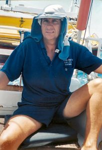 Right: The ‘shiek’ sitting on the tiller off the NW coast of Bathurst Island. Very still, glarey and hot conditions. Right: The ‘shiek’ sitting on the tiller off the NW coast of Bathurst Island. Very still, glarey and hot conditions.
Take down #1 jib and put up the genoa which brings us to to between 4 and 4.5 knots average. A school of tuna erupts in a feeding frenzy right next to the boat.
1400hrs: Wind can’t make up its mind where it wants to come from. Very difficult to set up a sail rig. Seems to be backing to the north. Change to goosewing rig with the heads’l poled out to windward, mains’l out to leeward.
1430hrs: Coastwatch flies over our mast and calls by radio. Give them all our details and expected ETA in Darwin.
1500hrs: Goosewing rig proves effective averaging 6 knots over the last hour. Wind is definitely steady from astern now. Horribilicus looking cumulu-nimbus clouds ahead. There appears to be a line of what looks like light rain squalls underneath them. Isolated showers with some gaps between them.
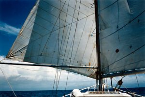 Left: Sails under goosewing rig approaching a line of apparent rain squalls. We were wrong. It became a full-on extensive storm front. Left: Sails under goosewing rig approaching a line of apparent rain squalls. We were wrong. It became a full-on extensive storm front.
Waypoint is 30nm away to the SW corner of Bathurst Island. Keeping well offshore to give lots of clearance to extensive shoals and reef areas off the coast. Haven’t actually sighted Bathurst Island as yet. It’s low set anyway and can usually be seen only from around 8 nm.
1600hrs: Hopeless. Wind has dropped away and the little bit of wind that’s left swings around to the NW and heads directly for the rain system ahead of us. Drop mains’l for a while to allow us to at least get back on course at a very slow speed using just the heads’l.
1615hrs: Give up the ghost with trying to sail. Our line of isolated rain squalls seems to have deepened into a weather front stretching 180 degrees across the SE across our track. The system has taken every breath of wind. Sails are flapping and we’re just drifting with the current. It’s overcast and much cooler too. Looks like we’re going to get a rain squall and there’s no way of avoiding it. Some gaps between the squalls. Will try for one.
Take down the sails and secure them. Turn on the motor and throttle up to around 5 knots with the intention to go through and out the other side.
Note:
With the benefit of hindsight the signs indicated something more severe than a line of isolated rain squalls. However we hadn’t heard any gale or storm warnings, and the weather forecasts we had listened to on H.F. radio were for 1m seas and isolated storms. I should have remember the old adage – there’s a calm before a storm.
There looks to be gaps between the showers which indicate the system is not very wide. Without the benefit of radar I’m unable to determine how deep or wide the system actually is, and we have no HF radio to check with OTC Darwin Radio. Try calling any ships on VHF Ch 16 for a forecast update, but get no response.
Consider heading for the shelter of the land but it’s over 10 nm away. We’d have to cross extensive shallow and uncharted areas, try to avoid reefs and there’s a very strong tidal influence. We’d be overtaken by the ‘squalls’ before we got close enough to anchor anyway.
We could run with the squalls to the NW but we’d still get dumped on. It’s an option that we can fall back on if need be.
But at this point the ‘line squall’ is not thought to be so bad, to decide to try and keep going S or SW. The big spring ebbing tide will push us away from land to give us more sea room.
1640hrs. Line squall going over us. Rain pelting down but seas not too bad. Martin on the tiller wearing a poncho and a cap on his head … yes! He has a CAP on to keep the rain and wind spray out of his eyes. The rain is more a nuisance than anything at this stage. Seas okay and no big deal. We’ll push on.
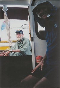 Right: A rare photograph of Martin with a hat on. At this point we’d gone through the first rain squall. We still couldn’t see ahead so the storm board in the companionway is left in place. This is the last photo anyone thought to take during the oncoming storm. Right: A rare photograph of Martin with a hat on. At this point we’d gone through the first rain squall. We still couldn’t see ahead so the storm board in the companionway is left in place. This is the last photo anyone thought to take during the oncoming storm.
1645hrs: Pass through a gap in the squall line. Can see Bathurst Island to port. That would be Rocky Point. Looking for the other side of these squalls to the south but no sign. It looks deeper if anything.
1920hrs: Waypoint is just 9 nm away now but we’re getting pushed slightly to westward by wind and tide. Cape Fourcroy light can be seen off the port bow. Very black out there. Still working our way southerly and being pushed westerly. Conditions are getting worse. Seas has turned to moderate but the winds keep building up.
Put up the mains’l with 2 reefs and sheet it in tightly to try and keep the boat a bit steadier. Sail is as flat as a board so as not to catch the wind and overpower the boat.
2100hrs. It’s hard to steer a steady course. The compass is swinging wildly and the only way to navigate is to use the Cape Fourcroy light as a reference point. Even this is hard to do as Lowana IV is thrown about to the demands of the wind and waves. The light is popping up everywhere from astern to well forward of the mast.
2200hrs: Have been trying to steer a course due south all this time. Being forced westward by the wind, the waves and a strong spring tide of over 5m. All together pretty powerful forces against which we can’t compete. Hope it will blow over soon.
2330hrs: Conditions have worsened and we’re in the pooh. Wind is screaming through the rigging. Huge waves. Still trying to head south but actually being forced quite fast to the WSW.
Don’t consider it safe to attempt to turn back for shelter behind Cape Fourcroy because the tide might push us onto reef when it eventually starts flooding easterly. We need more sea room so we’ll keep going westerly at this point. The more sea room the better. Just have to persevere for the time being. My biggest worry now is that Lowana IV gets side-on the seas and gets rolled over with a breaking wave. That must not happen.
Thu 24 Sep 98
0340hrs: Impossible to keep going like this. I’m getting concerned for the mast and rigging which is under terrible strain. Almost 13 nm to WSW of waypoint. Well out to sea in the Joseph Bonaparte Gulf. It’s time to stream a parachute drogue and attempt to ride out the storm.
Martin and I creep forward with harnesses attached. The boat is rocking violently from side to side but somehow we manage to get the mains’l down, lay the boom across the cockpit and lash everything down.
0450hrs: Have drifted 2 nm to the SW since taking down all sail. We now make our way forward under the soft, orange glow of the deck lights to the bow on our buttocks, me with the drogue and Martin following with the rope and chain. Blackness outside the boat is complete. As I sit next to the bowsprit Lowana IV repeatedly falls off the back of successive waves and plummets down into the troughs, landing with a jolt and sending up a solid wall of water which drenches both of us.
Am aware that once the drogue is thrown out into the sea the tension on the rope is going to be really heavy. This sea-anchor is going to have to hold 9 tons of boat head-on into the sea. Everything has to be arranged for it to pay out properly the first time and not snag an arm or leg. At the bottom of one of the troughs the drogue is thrown saucer wise and immediately the securing rope starts whizzing loudly through the rollers as it pays out. Finally it pulls taut. Lowana IVs bow jerks around and settles to to it. We’re still rocking violently but at least relatively safe. Hopefully most of us can now try and get some rest.
Try calling OTC Darwin Radio again on Ch16 VHF. No answer. Haven’t heard any other calls either. Signal probably blocked by the storm. Martin volunteers to stay up on watch.
0600hrs: Martin goes below to try and get some sleep. Am mildly surprised by the size of the waves. Conservatively estimate from the peaks and troughs that a two storey house would easily fit in there. That would make them about 6m waves and some of them even bigger. The tide has changed and is running easterly making it worse with a wind on tide situation. On the crest of each wave I can see the wind whipping froth off the seas and sending it in streaks across the surface. I estimate this storm to be at least Force 8 on the Beaufort Scale and probably even higher during last night.
It’s awesome to be on the crests looking down into the troughs. Lowana IV is rocking hard but riding the waves well. Some of them are quite sharp faced but she is meeting each one and lifting herself nicely over them.
The parachute drogue keeps her laying maybe 70 degrees to the waves. I’d prefer her to lay a bit higher into the waves, but the force of the tide keeps her at this angle. In any case the drogue keeps tugging the bow around just enough to stop her laying beam-on to the seas.
Have had some minor spillage of gear out of cupboards that have never spilled before. Only the occasional heavy slap on the side.
0700hrs: Have drifted just 1 nm to the SW on our drogue, equivalent to just under half a knot compared to 2 knots prior to getting the drogue out. It’s slowed us up considerably and keeping us a lot safer.
0800hrs: Miss the weather forecast on HF radio. Bugger it! A fawn coloured sea snake with a small head and about 1m long is swimming off the bow near the parachute drogue rope. Watch him for a while in case he decides to try and climb up the rope. The last thing we want is a hostile snake somewhere in the bilges. He hangs around the rope wriggling for a while but finally dives away.
0900hrs: Tide changes and starts ebbing westerly causing us to start drifting to the NW. A full wave gives a good solid thump to the side of the boat. Seas seem to be abating a little bit so bring in the drogue and start the motor.
Spend the next couple hours trying to make some headway to the east without success. The only directions where we can make any headway at all with or without sails, is NW towards Timor or SW to Western Australia.
Back to waiting it out. Put the drogue back out but this time with a piece of chain to to help keep it down in the water more, and take any slack out of the rope. It helps Lowana IV to sit a bit better to the waves.
1500hrs: Over the duration of the ebb tide we drift 9.5 nm to the NW but over the last hour it’s been more to the WSW. It’s been a very uncomfortable day but I’m not overly concerned about safety at this stage. It’s more a bloody nuisance and for all we know we might be here a couple more days yet. Just have to get used to the idea.
Tide is turning again. Everyone has tried unsuccessfully to get some sleep. Gear and rigging seems to be holding well so far. I’ve been around the boat but can’t find any apparent or potential problems.
1515hrs: Coastwatch flies over us again. Am pleased to see them so we can get a message out. Ask them to pass our position to OTC Darwin Radio and that we’re okay and just waiting out this storm. Also ask them to pass a message to our friend Dave Fields. They agree and tell us they will check on us again tomorrow.
1530hrs: Take stock of the sea and winds. It dawns on me that the seas have actually started to abate quite quickly, at least relative to what we had before. And the wind has also backed towards the east. Maybe we’ll at least be able to make some distance towards the south and the Northern Territory mainland.
Rouse the troops who drag themselves somewhat reluctantly into action. Retrieve and stow away the drogue. Turn the motor on and raise the sails with 2 reefs in the mains’l. By the time we do all this the wind has dropped even further. Great! The seas still quite big and the wind still strong but it’s manageable.
Shake out the remaining reef in the mains’l. By the time the sails are reset and sheeted we’re able to travel close hauled at about 4 knots on a SE course of about 150 degrees True. Excellent! If the weather holds out long enough we might be able to get under some shelter from the lee of Cox Peninsula.
1800hrs: Have covered 10 nm so far and looking okay. Tide is flooding easterly so that is giving us some assistance as well.
Coastwatch calls. They’ve passed our messages and inform us that Dave will have a hot meal ready for us when we return. Hearty news. Really appreciate Coastwatch for their help, knowing they aren’t actually required to pass personal messages for yachties. Advise Coastwatch we’ve managed to get underway and give them our present position, course and speed.
Dusk: A large schooner crosses our bow in the distance heading westerly. We make a minor alteration to course southerly to intercept her for a sticky beak. As we draw near she alters course to starboard and passes down our starboard side at a distance of about 50m. Her name is Ardella and she flies a U.S. flag. There are 5 men visible on deck including a big negro chap up on the bow.
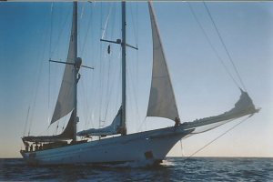 Left: The U.S. schooner Ardella passes by. She’s still got her storm rig up so it’s assumed she also got hit by the storm. Left: The U.S. schooner Ardella passes by. She’s still got her storm rig up so it’s assumed she also got hit by the storm.
1900hrs: Have been charging along quite nicely to the SE and have covered about 18 nm since getting underway. We now need to get more easterly as much as possible while we still have the tide run with us, so take a punt that the weather will hold and change course to the ESE.
2230hrs: Cross the 130 degree Longitude line. Our original waypoint was on this line but 20 nm to the north of where we are now. Making very good time. Conditions continue to slowly get calmer.
Fri 25 Sep 98
Overnight: Uneventful motor sailing throughout the night. Made excellent time getting 4 knots against the tide which was a bonus. Have been using the motor because the winds dropped right down to just light winds. I also want to make sure we can catch Customs before they knock off work today. Otherwise we’ll have to linger until Monday confined to the boat, or else pay an expensive after hours callout fee.
0600hrs: Beautiful morning. Seas calm with just a light breeze coming from the SE. Talk about contrasts. Have had the genoa headsail up most of the night but we now need to turn SE for a direct run into Darwin. Genoa taken down. Still getting some lift from the sheeted in mains’l. Coming abeam of the Charles Point light on the NW end of the Cox Peninsula.
0700hrs: Make a final turn and head directly for Cullen Bay in Darwin Harbour where we should be able to meet up with Customs for clearance. Steering 130 degrees True. A big freighter comes up astern and passes us on our port side also heading for Darwin.
0830hrs: Pass the #6 buoy at the harbour entrance and say ‘hullo’ to it. Contact OTC Darwin Radio on VHF Ch16. Give them our final position report and thank them for their assistance. Customs hear the exchange and enquire about clearance requirements, so we make arrangements to meet up with them.
0945hrs: Arrive at Cullen Bay and tie up to go through our quarantine and customs clearances. Customs confiscate all our lovely clam shells which are apparently a prohibited item. Shame that. Seems they’re trying to prevent a market for these shells otherwise the Indonesians would start to cull them big time. I’d believe that.
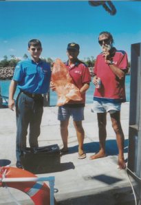 Right: Reluctantly handing over our collection of sea-shells. Right: Reluctantly handing over our collection of sea-shells.
1030hrs: Clear Customs and Quarantine. No problems with any of it. The chaps were very polite and very professional. Head back to Lowana IVs mooring in Sadgroves Creek. Have to push it really hard as the tide is going out at a fearful rate. Even the navigation buoys in the harbour are being bent over due to the force of it. No wonder we got pushed about so much out at Cape Fourcroy.
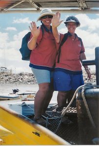 Left: The girls are the first to step ashore at the Dinah Beach Cruising Yacht Club pontoon. It’s their job to order the drinks, hamburgers and chips. Left: The girls are the first to step ashore at the Dinah Beach Cruising Yacht Club pontoon. It’s their job to order the drinks, hamburgers and chips.
1230hrs: There’s almost no water left in the creek and barely make it up the creek after the keel scrapes the bottom a couple of times. Finally tie up to our mooring. Turn off the motor and begin sorting out personal gear. Make two dinghy loads to ferry crew and gear to the Dinah Beach Cruising Yacht Club – DBCYC where we indulge in our much dreamed of hamburgers and ice cold drinks.
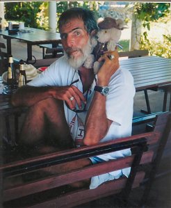 Right: The much travelled Captain Teddy makes a pig of himself. Couldn’t stand up and had to be carried home by his father. Right: The much travelled Captain Teddy makes a pig of himself. Couldn’t stand up and had to be carried home by his father.
Talk to a couple of people at DBCYC. Find out that OTC Darwin Radio had issued a PAN PAN broadcast about us after being informed of our situation by Coastwatch. It really wasn’t necessary but nice to know anyway. This was possibly why the schooner Ardella turned to take a closer look at us.
Note: A PAN PAN is issued where there are concerns for a vessel but where the vessel is not in any immediate danger.
MORE TO FOLLOW |